
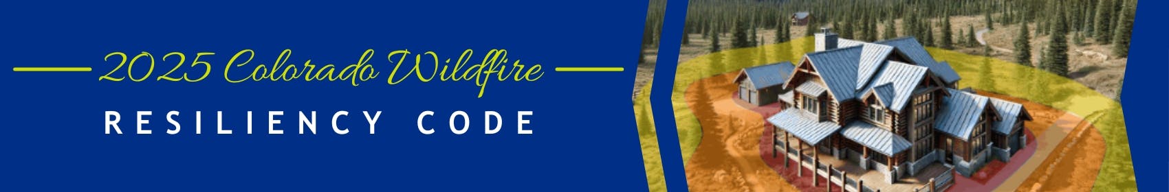
2025 Colorado Wildfire Resiliency Code
The following outlines a state-mandated code update in Colorado focusing on wildfire resiliency. The Colorado Wildfire Resiliency Code is detailed regulations for construction and property maintenance in wildland-urban interface areas, aiming to safeguard life and property from wildfires. It introduces two classes of structure hardening (Class 1 and Class 2) based on fire intensity classification (low, moderate, and high), outlining specific requirements for building materials, defensible space, and site features. The code also establishes an administrative framework for enforcement, permits, inspections, and an appeals process for governing bodies, with a three-year property evaluation requirement to ensure ongoing compliance.
Overview
The 2025 Colorado Wildfire Resiliency Code" (CWRC) Version 1.0, effective June 1, 2025, is a new comprehensive set of regulations designed to enhance life safety and property protection in Colorado's Wildland-Urban Interface (WUI) areas. Its core purpose is to mitigate the risks associated with wildland fires, specifically by preventing fire from spreading to structures and preventing structure fires from spreading to wildland fuels. The code supplements existing building and fire codes, and is designed with a tiered approach, meaning the requirements will vary based on the level of wildfire hazard present in a specific area. The CWRC required that local jurisdictions adopt the code by April 1, 2026 and that it be enforced by July 1, 2026.
View the full 2025 Colorado Wildfire Resiliency Code (CWRC) Version 1.0 State Code.
Learn more about Structure Hardening and Defensible Space.
Key Takeaways:
- Code Not Yet Adopted in Broomfield - The Wildfire Resilience Code has not been adopted by Broomfield at this time. Consideration of the CWRC will occur in 2026 with hearing dates not yet set. Broomfield has been working with a consultant, Blue Mountain Environmental, and the CWRC Board Administrator on the parameters for creating a local map. A meeting was held on March 26, 2026, in which staff received more guidance regarding the map requirements.
- Local Mapping Study Underway - Broomfield is conducting a pilot project to create a local map using the required mapping methodology specified by the CWRC Board. Broomfield has not yet filed a request for consideration of a local map specific to Broomfield. Now that the State has provided more guidance regarding the map requirements and review process, staff is working with our consultant to get an estimate for the work necessary to complete the map and submit it to the State for review. Once we have that information from the consultant, Staff will be better able to estimate the time needed to complete the work, engage with the community, and then submit the map to the State.
- Additional Community Engagement - A City Council study session and community meeting will be scheduled after the map is created to review the local mapping project and provide additional input on the CWRC prior to consideration of adoption. At this time, these meetings are not anticipated to occur until the second half of 2026.
Where does it apply?
Wildland-Urban Interface (WUI) Areas: The code applies to areas where human development meets or intermingles with wildland or vegetative fuels. The CWRC Board has adopted a map for the entire state, which defines fire intensity areas based on factors including vegetative fuels, topography, weather patterns, and fire behavior modeling. These areas are classified into Low, Moderate, and High Fire Intensity, which dictate the applicable code requirements. The City and County of Broomfield have areas that are classified as Low (yellow) and Moderate (orange) Fire Intensity.
What does it mean for residents?
Once adopted by Broomfield, WUI regulations will apply to the construction and alteration of structures (with occupiable or habitable space) and defensible space within designated fire hazard areas. The goal is to safeguard life and property from wildfire intrusion and prevent structure fires from spreading to wildland fuels.
When Does it Apply?
- New construction of structures and defensible space around structures - Residential and Commercial
- Significant alterations/additions/repairs
- 500sf+ increased footprint of a structure
- 25%+ of an exterior of a structure affected
- Roof covering replacement if 25% or more of the surface area is being replaced.
When Does it NOT Apply?
- Interior alterations of existing structures
- 35-acre+ parcels with only 1 residential structure NOT abutting residential or commercial area
- Exterior painting, staining, and similar routine maintenance
- Historic Structures: Variances may be issued for historic structures to preserve their character if they meet specific historic designations.
Community Engagement
You can engage with this project using the Questions and Comments tabs below. This page will be open to feedback and questions until the date of the City Council, 2nd reading Public Hearing. We will provide more about this hearing on this webpage before the meeting.
The project timeline on this page provides an overview of the next steps in the process as Broomfield considers the approval of this proposed ordinance.


Videos
-
Community meeting with the state regarding the 2025 Colorado Wildfire Resiliency Code.
Who's Listening
-
Senior Landscape Architect
Email kmack@broomfield.org