Open Space, Parks, Recreation, and Trails Plan
ARCHIVED
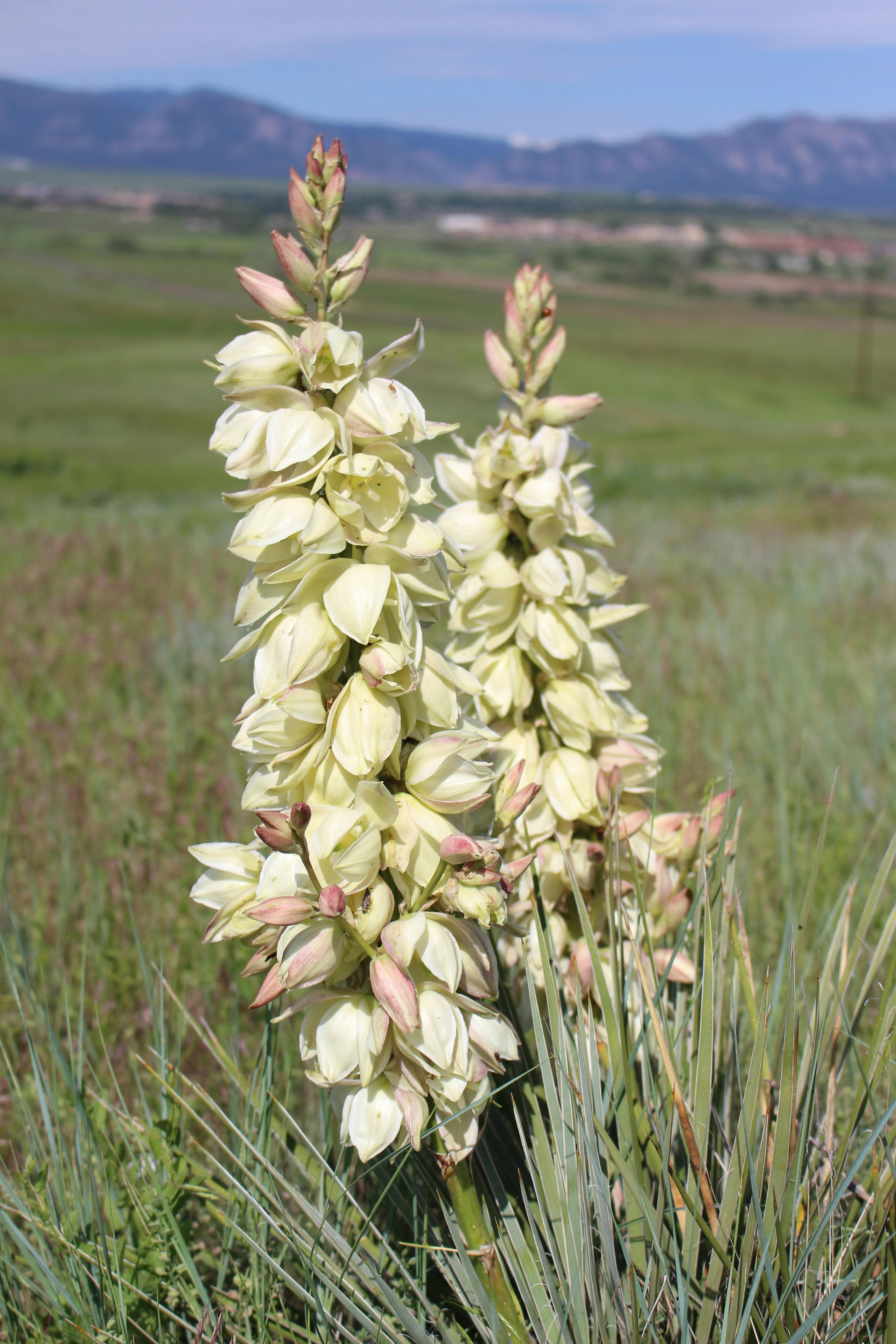
On February 27, City Council adopted the new plan that will serve as a guide for Open Space, Parks, Recreation and Trails over the next 20 years. Further questions please email openspace@broomfield.org.
Project Summary:
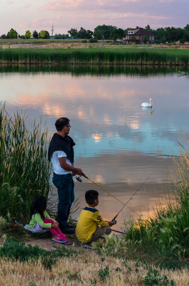
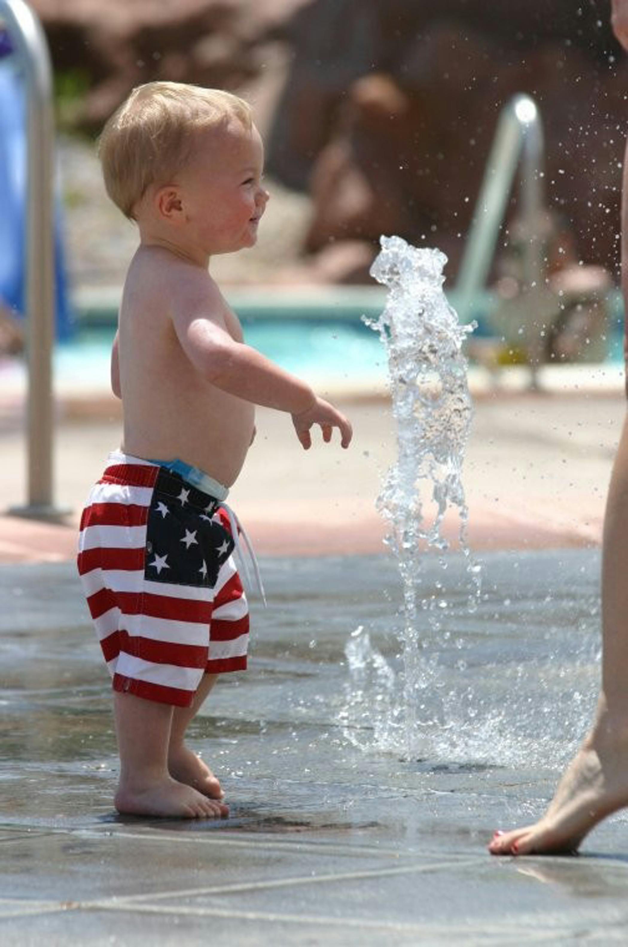
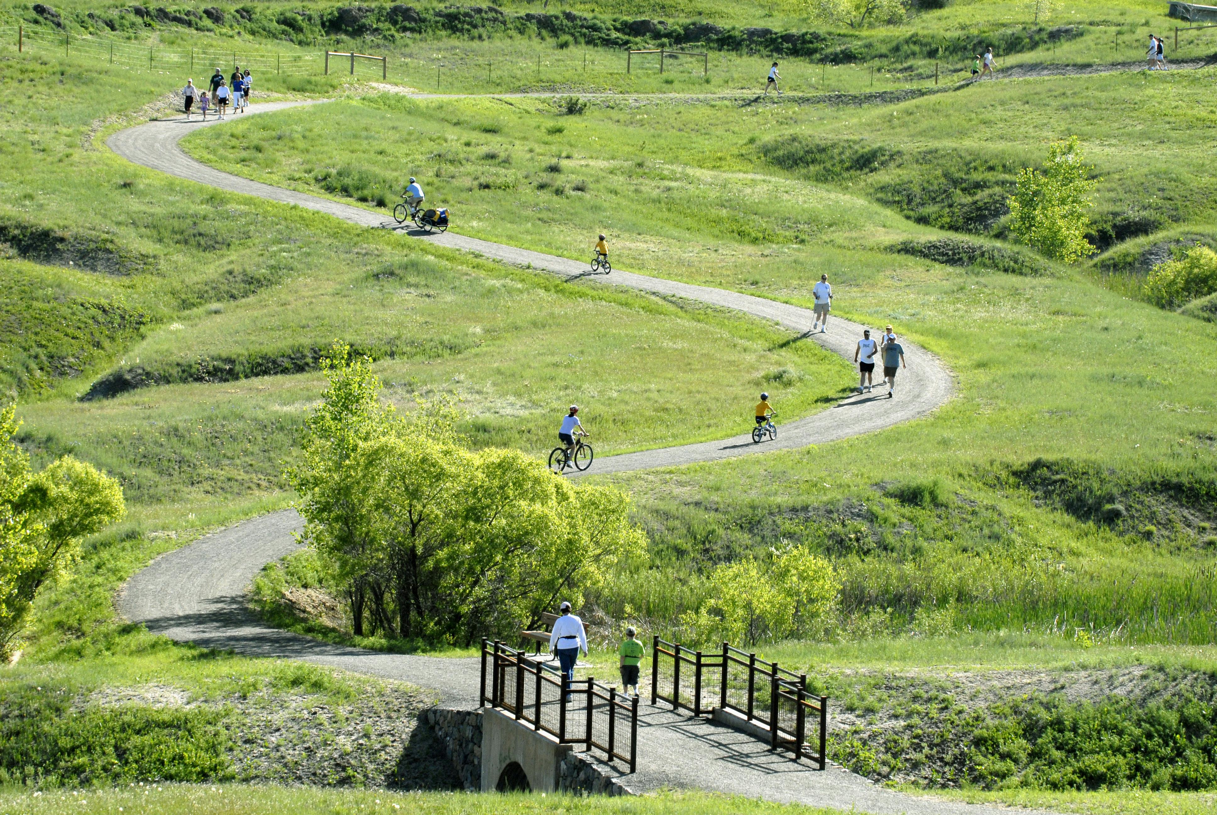
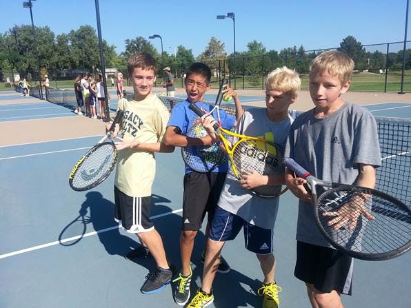
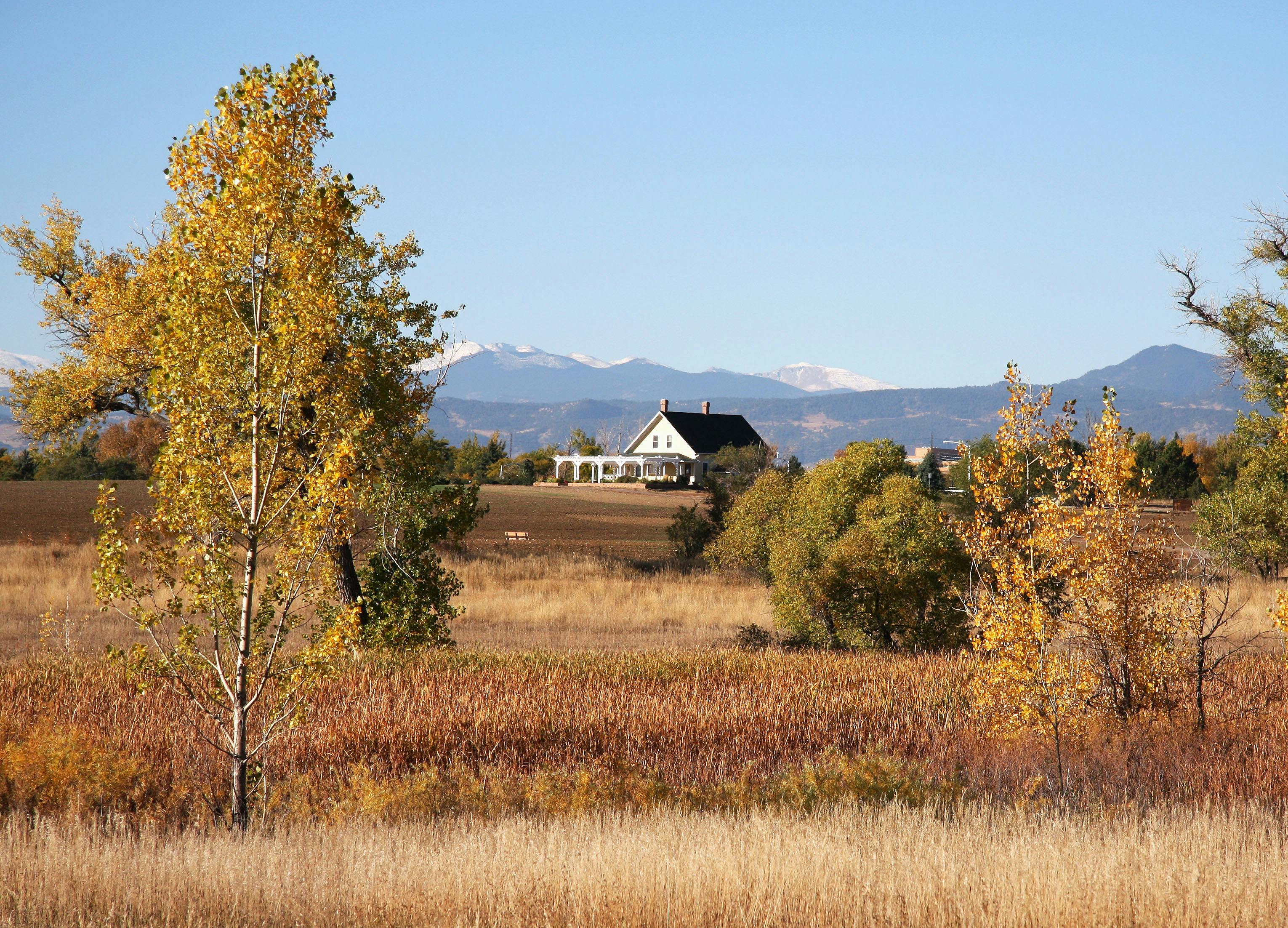
The Open Space, Parks, Recreation and Trails (OSPRT) Plan is a 20-year policy document intended to serve as a road map for Broomfield staff, elected officials, advisory committees, and the community to guide decisions about Open Space, Parks, recreation, and trails. The goal of the OSPRT Plan is to ensure that Broomfield’s vision of the community is carried forward into the future and to promote a strong sense of unity, pride, and identity. It includes an analysis of Broomfield’s current and future needs for Open Space, Parks, recreation, and trail facilities. The plan also outlines specific implementation strategies that will assist in achieving the community’s goals to acquire additional Open Lands and trails, preserve natural resources, and enhance existing spaces and facilities. Citizens may also look to the OSPRT Plan for guidance regarding the goals and commitments aimed at ensuring a sustainable future for Broomfield. The Plan is meant to be reviewed and amended to remain current with changing conditions within and outside Broomfield and is intended to be flexible as Broomfield continues to change and develop over the next 20 years.
Public Engagement Summary:
The OSPRT Plan is the result of sustained effort over a 2-year period that included the Open Space and Trails Advisory Committee (OSTAC), the Parks, Recreation and Senior Services Advisory Committee (PRSSAC), public engagement survey results and comments, City Council comments, and research and analysis by City staff and consultants. Community outreach was a part of the planning process from start to finish. Public engagement included 819 survey responses, 6 focus group meetings, 18 pop up events and other outreach efforts that were analyzed and summarized and utilized as a central guide in the planning process.
Open Space, Parks, Recreation and Trails Plan: Adopted!
Thank you to the many people that helped to brainstorm, give feedback, plan, draft and create the updated Open Space, Parks, Recreation and Trails Plan. On February 27, City Council adopted the new plan that will serve as a guide for Open Space, Parks, Recreation and Trails over the next 20 years.
View the Executive Summary here.
View the Plan here.
View Appendices here.
The City and County of Broomfield (CCOB) implemented a combination of focus group discussions, community events, a survey, and conversations with diverse populations to elicit feedback throughout the OSPRT Plan process. This feedback shaped the update of existing strategies that protect and preserve Broomfield’s open space, parks, trails, natural resources, and recreational amenities for the coming years.
Track progress on the Refresh:
Sign up for the Open Space and Trails, Senior News, or Recreation newsletter
Haga clic aquí para la página en español
Project Summary:
The Open Space, Parks, Recreation and Trails (OSPRT) Plan is a 20-year policy document intended to serve as a road map for Broomfield staff, elected officials, advisory committees, and the community to guide decisions about Open Space, Parks, recreation, and trails. The goal of the OSPRT Plan is to ensure that Broomfield’s vision of the community is carried forward into the future and to promote a strong sense of unity, pride, and identity. It includes an analysis of Broomfield’s current and future needs for Open Space, Parks, recreation, and trail facilities. The plan also outlines specific implementation strategies that will assist in achieving the community’s goals to acquire additional Open Lands and trails, preserve natural resources, and enhance existing spaces and facilities. Citizens may also look to the OSPRT Plan for guidance regarding the goals and commitments aimed at ensuring a sustainable future for Broomfield. The Plan is meant to be reviewed and amended to remain current with changing conditions within and outside Broomfield and is intended to be flexible as Broomfield continues to change and develop over the next 20 years.
Public Engagement Summary:
The OSPRT Plan is the result of sustained effort over a 2-year period that included the Open Space and Trails Advisory Committee (OSTAC), the Parks, Recreation and Senior Services Advisory Committee (PRSSAC), public engagement survey results and comments, City Council comments, and research and analysis by City staff and consultants. Community outreach was a part of the planning process from start to finish. Public engagement included 819 survey responses, 6 focus group meetings, 18 pop up events and other outreach efforts that were analyzed and summarized and utilized as a central guide in the planning process.
Open Space, Parks, Recreation and Trails Plan: Adopted!
Thank you to the many people that helped to brainstorm, give feedback, plan, draft and create the updated Open Space, Parks, Recreation and Trails Plan. On February 27, City Council adopted the new plan that will serve as a guide for Open Space, Parks, Recreation and Trails over the next 20 years.
View the Executive Summary here.
View the Plan here.
View Appendices here.
The City and County of Broomfield (CCOB) implemented a combination of focus group discussions, community events, a survey, and conversations with diverse populations to elicit feedback throughout the OSPRT Plan process. This feedback shaped the update of existing strategies that protect and preserve Broomfield’s open space, parks, trails, natural resources, and recreational amenities for the coming years.
Track progress on the Refresh:
Sign up for the Open Space and Trails, Senior News, or Recreation newsletter
Haga clic aquí para la página en español
ARCHIVED
On February 27, City Council adopted the new plan that will serve as a guide for Open Space, Parks, Recreation and Trails over the next 20 years. Further questions please email openspace@broomfield.org.
-
Share I'm fortunate to live on open space near the wonderful trails Broomfield provides. Broomfield used to manage the prairie dog population to keep them west of the trail near where I live. This seems to have stopped happening. This is allowing them to spread ever closer to homes. Some residents are even feeding them! This concerns me, both from a property damage perspective since they can rapidly demolish meticulously cared for landscape, but also from a health perspective since they can be disease carriers (such as plague). I'd really like to see management be reinstated or a good plan put in place so residents can protect themselves from the encroaching prairie dog population. on Facebook Share I'm fortunate to live on open space near the wonderful trails Broomfield provides. Broomfield used to manage the prairie dog population to keep them west of the trail near where I live. This seems to have stopped happening. This is allowing them to spread ever closer to homes. Some residents are even feeding them! This concerns me, both from a property damage perspective since they can rapidly demolish meticulously cared for landscape, but also from a health perspective since they can be disease carriers (such as plague). I'd really like to see management be reinstated or a good plan put in place so residents can protect themselves from the encroaching prairie dog population. on X (formerly Twitter) Share I'm fortunate to live on open space near the wonderful trails Broomfield provides. Broomfield used to manage the prairie dog population to keep them west of the trail near where I live. This seems to have stopped happening. This is allowing them to spread ever closer to homes. Some residents are even feeding them! This concerns me, both from a property damage perspective since they can rapidly demolish meticulously cared for landscape, but also from a health perspective since they can be disease carriers (such as plague). I'd really like to see management be reinstated or a good plan put in place so residents can protect themselves from the encroaching prairie dog population. on Linkedin Email I'm fortunate to live on open space near the wonderful trails Broomfield provides. Broomfield used to manage the prairie dog population to keep them west of the trail near where I live. This seems to have stopped happening. This is allowing them to spread ever closer to homes. Some residents are even feeding them! This concerns me, both from a property damage perspective since they can rapidly demolish meticulously cared for landscape, but also from a health perspective since they can be disease carriers (such as plague). I'd really like to see management be reinstated or a good plan put in place so residents can protect themselves from the encroaching prairie dog population. link
I'm fortunate to live on open space near the wonderful trails Broomfield provides. Broomfield used to manage the prairie dog population to keep them west of the trail near where I live. This seems to have stopped happening. This is allowing them to spread ever closer to homes. Some residents are even feeding them! This concerns me, both from a property damage perspective since they can rapidly demolish meticulously cared for landscape, but also from a health perspective since they can be disease carriers (such as plague). I'd really like to see management be reinstated or a good plan put in place so residents can protect themselves from the encroaching prairie dog population.
DaveM asked over 2 years agoThank you for your inquiry. While it is never easy to maintain boundaries of prairie dog colonies, Broomfield staff does continue to try to protect trail corridors and private property buffers from prairie dog encroachment and damages. We also try to always prevent the feeding of wildlife and can address that situation directly if needed. It is difficult to comment more specifically without knowing the exact location being referenced, but please feel free to contact openspace@broomfield.org with more information and we can follow up. Thank you.
-
Share How should members of the public provide feedback/make requests regarding open spaces & parks? There is a large community of users for The Ridge Park and its walking trails/open space, but a noticable lack of lighting during the winter and daylight savings time. The lack of lighting means the community does not feel safe utilizing the space after 5pm or early in the morning, as visibility is very poor and you cannot see across the field. Lighting is very dim where available, and only along the roads and not the actual park space. I'd be happy to provide feedback in a more appropriate space, but there isn't any easily accessible information on how to contact the city/county on these issues. on Facebook Share How should members of the public provide feedback/make requests regarding open spaces & parks? There is a large community of users for The Ridge Park and its walking trails/open space, but a noticable lack of lighting during the winter and daylight savings time. The lack of lighting means the community does not feel safe utilizing the space after 5pm or early in the morning, as visibility is very poor and you cannot see across the field. Lighting is very dim where available, and only along the roads and not the actual park space. I'd be happy to provide feedback in a more appropriate space, but there isn't any easily accessible information on how to contact the city/county on these issues. on X (formerly Twitter) Share How should members of the public provide feedback/make requests regarding open spaces & parks? There is a large community of users for The Ridge Park and its walking trails/open space, but a noticable lack of lighting during the winter and daylight savings time. The lack of lighting means the community does not feel safe utilizing the space after 5pm or early in the morning, as visibility is very poor and you cannot see across the field. Lighting is very dim where available, and only along the roads and not the actual park space. I'd be happy to provide feedback in a more appropriate space, but there isn't any easily accessible information on how to contact the city/county on these issues. on Linkedin Email How should members of the public provide feedback/make requests regarding open spaces & parks? There is a large community of users for The Ridge Park and its walking trails/open space, but a noticable lack of lighting during the winter and daylight savings time. The lack of lighting means the community does not feel safe utilizing the space after 5pm or early in the morning, as visibility is very poor and you cannot see across the field. Lighting is very dim where available, and only along the roads and not the actual park space. I'd be happy to provide feedback in a more appropriate space, but there isn't any easily accessible information on how to contact the city/county on these issues. link
How should members of the public provide feedback/make requests regarding open spaces & parks? There is a large community of users for The Ridge Park and its walking trails/open space, but a noticable lack of lighting during the winter and daylight savings time. The lack of lighting means the community does not feel safe utilizing the space after 5pm or early in the morning, as visibility is very poor and you cannot see across the field. Lighting is very dim where available, and only along the roads and not the actual park space. I'd be happy to provide feedback in a more appropriate space, but there isn't any easily accessible information on how to contact the city/county on these issues.
egrace asked over 2 years agoThank you for your question. It seems your question is related to the Ridge Park, part of the Broomfield Parks department. Please submit your question to parks@broomfield.org and they would be happy to respond directly to your concern.
-
Share Is there a place where there is a consolidated list of what is considered "active" and "passive" recreation? Or is there a general rule of thumb that you can share? I am wondering about the multi-use trails that run thru open spaces and how they are labeled (I suppose they must be passive) or if there is some sort of easement to allow those to pass thru open spaces. I think that all the multi-use trails that have been added to connect open spaces and other trails are so wonderful. The advances that open space, trails, and recreation have made in Broomfield over the past 10 years have been so valuable and I commend and appreciate your efforts and continued commitment to this mission. on Facebook Share Is there a place where there is a consolidated list of what is considered "active" and "passive" recreation? Or is there a general rule of thumb that you can share? I am wondering about the multi-use trails that run thru open spaces and how they are labeled (I suppose they must be passive) or if there is some sort of easement to allow those to pass thru open spaces. I think that all the multi-use trails that have been added to connect open spaces and other trails are so wonderful. The advances that open space, trails, and recreation have made in Broomfield over the past 10 years have been so valuable and I commend and appreciate your efforts and continued commitment to this mission. on X (formerly Twitter) Share Is there a place where there is a consolidated list of what is considered "active" and "passive" recreation? Or is there a general rule of thumb that you can share? I am wondering about the multi-use trails that run thru open spaces and how they are labeled (I suppose they must be passive) or if there is some sort of easement to allow those to pass thru open spaces. I think that all the multi-use trails that have been added to connect open spaces and other trails are so wonderful. The advances that open space, trails, and recreation have made in Broomfield over the past 10 years have been so valuable and I commend and appreciate your efforts and continued commitment to this mission. on Linkedin Email Is there a place where there is a consolidated list of what is considered "active" and "passive" recreation? Or is there a general rule of thumb that you can share? I am wondering about the multi-use trails that run thru open spaces and how they are labeled (I suppose they must be passive) or if there is some sort of easement to allow those to pass thru open spaces. I think that all the multi-use trails that have been added to connect open spaces and other trails are so wonderful. The advances that open space, trails, and recreation have made in Broomfield over the past 10 years have been so valuable and I commend and appreciate your efforts and continued commitment to this mission. link
Is there a place where there is a consolidated list of what is considered "active" and "passive" recreation? Or is there a general rule of thumb that you can share? I am wondering about the multi-use trails that run thru open spaces and how they are labeled (I suppose they must be passive) or if there is some sort of easement to allow those to pass thru open spaces. I think that all the multi-use trails that have been added to connect open spaces and other trails are so wonderful. The advances that open space, trails, and recreation have made in Broomfield over the past 10 years have been so valuable and I commend and appreciate your efforts and continued commitment to this mission.
over 2 years agoThank you for the positive feedback about Broomfield’s Open Space, Parks, Recreation, and Trails. We are glad that you are enjoying these areas.
Here is a link to Appendix D Management Classification and Guidelines for Public Use (Appendix D) from our 2005 Open Space, Parks, Recreation, and Trails Plan. This matrix identifies uses and guidelines for open space and parks.
Trails, including non-motorized multi-use concrete paths and crusher fines trails, are open space uses subject to environmental review, public engagement, and technical site analysis. Even though the matrix does not specifically list a single track trail, it could be considered under the soft surface trail category in the matrix. An example of a single track trail would be the High Plains Trail off of State Highway 93 and State Highway 128 in Boulder County. These types of trails are considered passive recreational uses. Any type of proposed trail is evaluated for its appropriateness for an open space site based on the proposed project’s environmental impacts on wildlife, erosion impacts, site grading requirements, floodplain, wetlands, slope stability, amount of overall disturbance. etc. as the preservation of the character of the open space property is a primary concern. New trail projects typically include this type of research in addition to a robust public engagement process.
In respect to a single track bike park, this is more of a Specialized Active Recreation Facility as it includes a network of interconnected single track trails designated for single track use that often requires grading to create banked turns and jumps. Please see the Video of the Erie Single Track Bike Park that seems to capture the experience well at the Erie Single Track Bike Park. Appendix D under Parks defines a Specialized Active Recreation Facility as:
“The specialized active recreation facility classification is intended
to cover areas of heavily programmed athletic activities, ranging
from a sports complex with multiple fields, to a single use area like a skateboard park or BMX track.”
We are planning to update Appendix D through our work on the Open Space, Parks, Recreation and Trails Action Plan (OSPRT Action Plan). Single Track and the Single Track Bike Park can be addressed in this matrix. As mentioned in the earlier email, we can add an OSPRT Action Plan objective to seek a site for a future bike park development on an appropriate Park or Other Open Lands property.
-
Share I wanted to suggest a bike singletrack set of trails similar to the Erie Singletrack Trails at Sunset Open space https://www.erieco.gov/1672/Singletrack-Trails Erie Singletrack Trails at Sunset Open Space | Erie, CO I think that this would be a great addition to the community and would complement many of the great trails that Broomfield has to offer. I have gone and used both the bike parks at the Anthem Community Park and McKay Park. I found that both of these parks are for very specialized bike skills such as jumps, wood features, and pump tracks. I think that these are great parks and wonderful to provide access to the public to hone these biking skills. However, I think that this serves a narrow demographic of the general population. Additionally, both of these parks are located on the borders of Broomfield and far for many Broomfielders to access. I have used the Erie Singletrack trails several times and find a wider demographic and age range there than what I have experienced at McKay and Anthem. Similarly, I generally see more use of the Erie Singletrack, which I believe is due to them being more versatile than what is provided at McKay and Anthem. Urban and Suburban singletrack trails are becoming more common in progressive and innovative towns (Urban - Bentonville, AR; Suburban - Erie Singletrack Sunset OS and Maryland Mountain in Genesee) and I think that they are an amazing way to serve the population in townships. I think that it would also be great if these bike singletrack trails could be closer to the center of Broomfield as to serve Broomfeilders better. The OS along 287 may be a potential place as a starting point. These are just my thoughts on this and I appreciate your consideration. Please feel free to contact me with any questions for if there are specific meeting or public hearings that you think that I should attend. Sincerely, Chris Stamper on Facebook Share I wanted to suggest a bike singletrack set of trails similar to the Erie Singletrack Trails at Sunset Open space https://www.erieco.gov/1672/Singletrack-Trails Erie Singletrack Trails at Sunset Open Space | Erie, CO I think that this would be a great addition to the community and would complement many of the great trails that Broomfield has to offer. I have gone and used both the bike parks at the Anthem Community Park and McKay Park. I found that both of these parks are for very specialized bike skills such as jumps, wood features, and pump tracks. I think that these are great parks and wonderful to provide access to the public to hone these biking skills. However, I think that this serves a narrow demographic of the general population. Additionally, both of these parks are located on the borders of Broomfield and far for many Broomfielders to access. I have used the Erie Singletrack trails several times and find a wider demographic and age range there than what I have experienced at McKay and Anthem. Similarly, I generally see more use of the Erie Singletrack, which I believe is due to them being more versatile than what is provided at McKay and Anthem. Urban and Suburban singletrack trails are becoming more common in progressive and innovative towns (Urban - Bentonville, AR; Suburban - Erie Singletrack Sunset OS and Maryland Mountain in Genesee) and I think that they are an amazing way to serve the population in townships. I think that it would also be great if these bike singletrack trails could be closer to the center of Broomfield as to serve Broomfeilders better. The OS along 287 may be a potential place as a starting point. These are just my thoughts on this and I appreciate your consideration. Please feel free to contact me with any questions for if there are specific meeting or public hearings that you think that I should attend. Sincerely, Chris Stamper on X (formerly Twitter) Share I wanted to suggest a bike singletrack set of trails similar to the Erie Singletrack Trails at Sunset Open space https://www.erieco.gov/1672/Singletrack-Trails Erie Singletrack Trails at Sunset Open Space | Erie, CO I think that this would be a great addition to the community and would complement many of the great trails that Broomfield has to offer. I have gone and used both the bike parks at the Anthem Community Park and McKay Park. I found that both of these parks are for very specialized bike skills such as jumps, wood features, and pump tracks. I think that these are great parks and wonderful to provide access to the public to hone these biking skills. However, I think that this serves a narrow demographic of the general population. Additionally, both of these parks are located on the borders of Broomfield and far for many Broomfielders to access. I have used the Erie Singletrack trails several times and find a wider demographic and age range there than what I have experienced at McKay and Anthem. Similarly, I generally see more use of the Erie Singletrack, which I believe is due to them being more versatile than what is provided at McKay and Anthem. Urban and Suburban singletrack trails are becoming more common in progressive and innovative towns (Urban - Bentonville, AR; Suburban - Erie Singletrack Sunset OS and Maryland Mountain in Genesee) and I think that they are an amazing way to serve the population in townships. I think that it would also be great if these bike singletrack trails could be closer to the center of Broomfield as to serve Broomfeilders better. The OS along 287 may be a potential place as a starting point. These are just my thoughts on this and I appreciate your consideration. Please feel free to contact me with any questions for if there are specific meeting or public hearings that you think that I should attend. Sincerely, Chris Stamper on Linkedin Email I wanted to suggest a bike singletrack set of trails similar to the Erie Singletrack Trails at Sunset Open space https://www.erieco.gov/1672/Singletrack-Trails Erie Singletrack Trails at Sunset Open Space | Erie, CO I think that this would be a great addition to the community and would complement many of the great trails that Broomfield has to offer. I have gone and used both the bike parks at the Anthem Community Park and McKay Park. I found that both of these parks are for very specialized bike skills such as jumps, wood features, and pump tracks. I think that these are great parks and wonderful to provide access to the public to hone these biking skills. However, I think that this serves a narrow demographic of the general population. Additionally, both of these parks are located on the borders of Broomfield and far for many Broomfielders to access. I have used the Erie Singletrack trails several times and find a wider demographic and age range there than what I have experienced at McKay and Anthem. Similarly, I generally see more use of the Erie Singletrack, which I believe is due to them being more versatile than what is provided at McKay and Anthem. Urban and Suburban singletrack trails are becoming more common in progressive and innovative towns (Urban - Bentonville, AR; Suburban - Erie Singletrack Sunset OS and Maryland Mountain in Genesee) and I think that they are an amazing way to serve the population in townships. I think that it would also be great if these bike singletrack trails could be closer to the center of Broomfield as to serve Broomfeilders better. The OS along 287 may be a potential place as a starting point. These are just my thoughts on this and I appreciate your consideration. Please feel free to contact me with any questions for if there are specific meeting or public hearings that you think that I should attend. Sincerely, Chris Stamper link
I wanted to suggest a bike singletrack set of trails similar to the Erie Singletrack Trails at Sunset Open space https://www.erieco.gov/1672/Singletrack-Trails Erie Singletrack Trails at Sunset Open Space | Erie, CO I think that this would be a great addition to the community and would complement many of the great trails that Broomfield has to offer. I have gone and used both the bike parks at the Anthem Community Park and McKay Park. I found that both of these parks are for very specialized bike skills such as jumps, wood features, and pump tracks. I think that these are great parks and wonderful to provide access to the public to hone these biking skills. However, I think that this serves a narrow demographic of the general population. Additionally, both of these parks are located on the borders of Broomfield and far for many Broomfielders to access. I have used the Erie Singletrack trails several times and find a wider demographic and age range there than what I have experienced at McKay and Anthem. Similarly, I generally see more use of the Erie Singletrack, which I believe is due to them being more versatile than what is provided at McKay and Anthem. Urban and Suburban singletrack trails are becoming more common in progressive and innovative towns (Urban - Bentonville, AR; Suburban - Erie Singletrack Sunset OS and Maryland Mountain in Genesee) and I think that they are an amazing way to serve the population in townships. I think that it would also be great if these bike singletrack trails could be closer to the center of Broomfield as to serve Broomfeilders better. The OS along 287 may be a potential place as a starting point. These are just my thoughts on this and I appreciate your consideration. Please feel free to contact me with any questions for if there are specific meeting or public hearings that you think that I should attend. Sincerely, Chris Stamper
Chris_Stamper asked almost 3 years agoWe appreciate your interest in an active single track bike park!
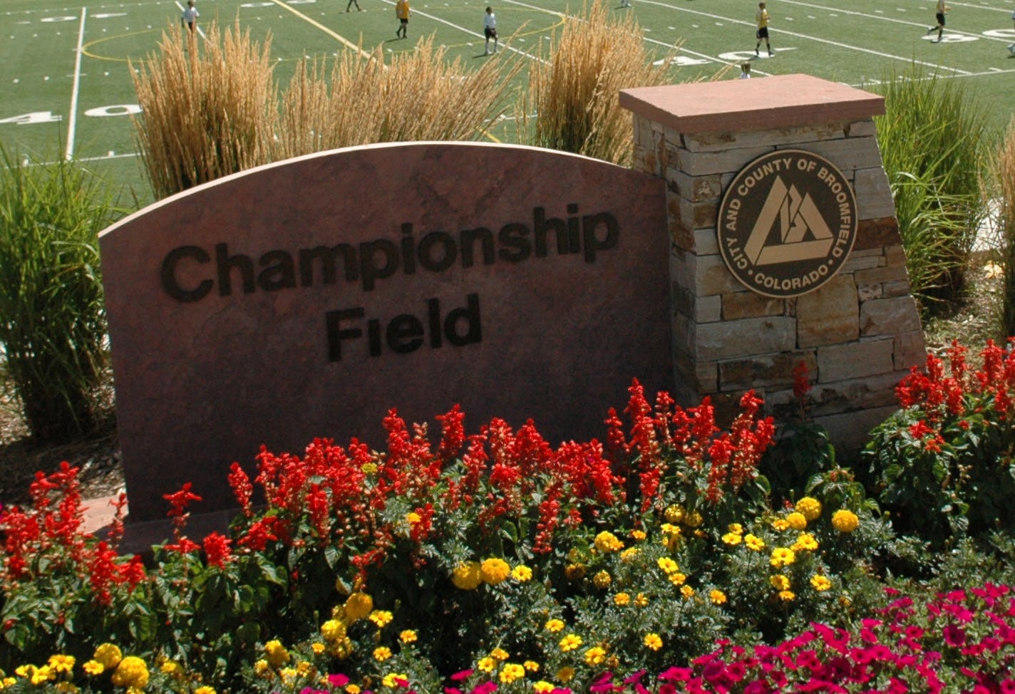
A single track bike park, similar to the Erie Bike Park, is an active recreational use that could be provided on land designated for Park or Other Open Lands such as the Broomfield Reservoir site. Parks and Recreation areas are defined as the most intensely developed and used types of Open Lands. They may contain open turf areas that may or may not be irrigated for passive recreation, active recreation playing fields,hard courts, picnic areas, restroom facilities, and other improvements.
The DRAFT Master Plan for the Broomfield Reservoir (DRAFT Plan) also included the concept of a non-motorized BMX track. However, it is important to underscore that this Master Plan was never finally approved. The DRAFT Plan merely shows concepts for this site that were considered in 2009 by both the Open Space and Trails Advisory Committee and the Parks, Recreation and Senior Services Advisory Committees at the time. Further work and public engagement are needed before this DRAFT Plan could be finalized.
The current DRAFT OSPRT Action Plan notes on our proposed trails plan a potential location for a single track trail around the future Broomfield Reservoir site subject to addressing the reservoir's public safety and design requirements. This property is located at Lowell Boulevard and Sheridan Boulevard. We can add an OSPRT Action Plan objective to seek a site for a future bike park development on an appropriate Park or Other Open Lands property.
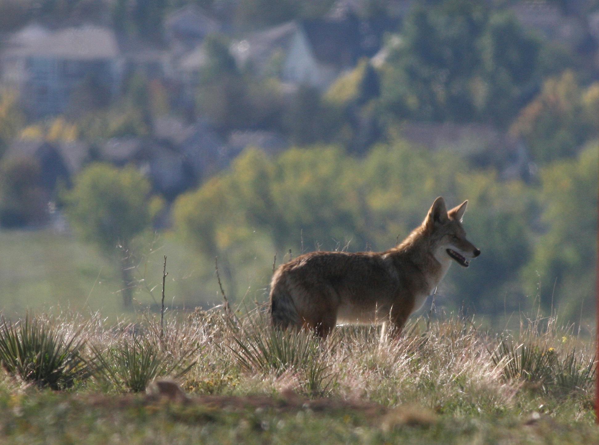
Active Bike Parks are not allowed on open space properties. The Ridgeview Open Space is a site that currently has a prairie dog colony, burrowing owls, and a coyote den. Open Space means a parcel of land intentionally protected from development and/or set aside for unstructured, passive recreation and the appreciation of natural surroundings. Open Space may contain but is not limited to trailheads and trails, waterbodies, wetlands, wildlife viewing areas, agricultural lands, fishing facilities, and other facilities that support uses compatible with site resources and conditions.
You are welcome to attend the joint Open Space and Trails Advisory Committee/Parks, Recreation and Senior Services Advisory Committee meeting on October 26, Thursday. The meeting begins at 6:00 p.m. and will be held at the Broomfield Community Center located at 280 Spader Way in the Lakeshore meeting room.
-
Share Suggesting to install a striped CROSSWALK at Paul Derda - from the east end of the parking lot to the trailhead (west of Lowell). Drivers turning left from Lowell into the rec center typically speed from the street into the lot, endangering pedestrians crossing the driveway going in, or walking to the trailhead. Thanks! on Facebook Share Suggesting to install a striped CROSSWALK at Paul Derda - from the east end of the parking lot to the trailhead (west of Lowell). Drivers turning left from Lowell into the rec center typically speed from the street into the lot, endangering pedestrians crossing the driveway going in, or walking to the trailhead. Thanks! on X (formerly Twitter) Share Suggesting to install a striped CROSSWALK at Paul Derda - from the east end of the parking lot to the trailhead (west of Lowell). Drivers turning left from Lowell into the rec center typically speed from the street into the lot, endangering pedestrians crossing the driveway going in, or walking to the trailhead. Thanks! on Linkedin Email Suggesting to install a striped CROSSWALK at Paul Derda - from the east end of the parking lot to the trailhead (west of Lowell). Drivers turning left from Lowell into the rec center typically speed from the street into the lot, endangering pedestrians crossing the driveway going in, or walking to the trailhead. Thanks! link
Suggesting to install a striped CROSSWALK at Paul Derda - from the east end of the parking lot to the trailhead (west of Lowell). Drivers turning left from Lowell into the rec center typically speed from the street into the lot, endangering pedestrians crossing the driveway going in, or walking to the trailhead. Thanks!
L M asked almost 3 years agoThank you for your comment. We are not quite sure the exact area that you are referring to; if you could, please email openspace@broomfield.org and we are happy to work with you to determine this location. Once we have this, we will forward this to the Broomfield Transportation staff to evaluate the safety of all crossings off of Lowell Blvd into and around Paul Derda Recreation Center. The transportation team will evaluate and monitor these areas for adding more crosswalks and other potential safety improvements.
-
Share How much are the taxpayers paying for each time the “fields” in Broomfield are plowed under? Please include both the field off of 3rd and Main and the commons. Additionally, how many times per year they are plowed under on Facebook Share How much are the taxpayers paying for each time the “fields” in Broomfield are plowed under? Please include both the field off of 3rd and Main and the commons. Additionally, how many times per year they are plowed under on X (formerly Twitter) Share How much are the taxpayers paying for each time the “fields” in Broomfield are plowed under? Please include both the field off of 3rd and Main and the commons. Additionally, how many times per year they are plowed under on Linkedin Email How much are the taxpayers paying for each time the “fields” in Broomfield are plowed under? Please include both the field off of 3rd and Main and the commons. Additionally, how many times per year they are plowed under link
How much are the taxpayers paying for each time the “fields” in Broomfield are plowed under? Please include both the field off of 3rd and Main and the commons. Additionally, how many times per year they are plowed under
Bryan Lingo asked almost 3 years agoThank you for your interest in Broomfield’s open space and your farming question.
Broomfield works with two farmers. Neither farmer is paid for farming. One farmer farms:
The Field Open Space (63 acres)
Broomfield County Commons Open Space (77 acres).
Wottge Open Space (72 acres) Southwest corner of the intersection of 144 and Sheridan
Davis Open Space (59 acres) South of the Northwest Parkway, and East of Zuni
Nordstrom (88 acres) South of the Northwest Parkway, West of Huron and South of 160
This farmer is paid to make temporary accommodations on a portion of the Broomfield County Commons Open Space for the annual July 4 fireworks launching area and safety zone. The field is prepared for this community event to address public safety concerns, particularly fire. The safety zone has these general requirements:
840-foot diameter circle (a.k.a., fallout area) is mowed (1 to 4 inch height maximum) or tilled (preferred for safety) for fire protection around the fireworks launch site.
A temporary parking area for up to 8 vehicles is needed for the Firing Crew’s vehicles approx. and the actual launch site with trailers and other equipment generally about 350 feet by 150 feet in size.
The center of the fallout area may need to be graded or leveled to provide adequate access.
A temporary access road 8 feet in width needs to be created for vehicular access to the launch site.
The farmer is paid (not to exceed) $3,200 for the fireworks preparation.
We also have another farmer that farms the Harmer Open Space (132 acres). He is also not paid and has farmed this property for many years before Broomfield purchased the land as open space. Broomfield inherited this lease and has maintained the same provisions generally that the farmer had in the previous lease with the family that owned this land before Broomfield purchased it. He also provides Broomfield with a ⅓ of the profits from the farming and continues to utilize the FRICO-Marshall ditch water shares historically used to irrigate this property.
Below is some additional background on open space and farming:
Farming is part of Broomfield’s history. Open Space includes agricultural lands as well as lands that have native grasses and wildflowers. In general, residents have indicated appreciation for seeing the cycle of the seasons that farming reflects as well as the beauty of native areas. These agricultural properties are included in Broomfield’s total open space acres.
The portions of the Broomfield County Commons Open Space and the Field Open Space agricultural lands are tilled and periodically fallow. Tilling typically occurs once in the spring and once in the fall. If the field is scheduled for planting, the field is tilled right before the seed is planted. Tilling helps to manage the weeds and also breaks up the hard layer of clay and soil that often forms in Broomfield soils given their high clay content. This fall, the farmer intends to plant triticale at Broomfield County Commons and winter wheat at the Field. Triticale is a hybrid of wheat and rye.
The intent is to eventually convert both sites to native grasses over the long-term. The establishment of a native landscape requires intensive weed management and takes 5 to 10 years to establish.
Here is a link to the Broomfield County Commons Management Plan. Here is a link to the The Field Master Plan and Recommendations.
Broomfield also has natural areas at Broomfield County Commons and the Field and is working with volunteers and our Broomfield Open Space Foundation on habitat enhancement. If you are interested in this type of volunteer opportunity, please sign up on Volunteer Hub and you will be notified about upcoming habitat projects as well as other open space volunteer events. Our Open Space and Trails website also provides information on volunteering.
-
Share Hi there! Has the city ever considered purchasing Eagle Trace Golf Course? The management of this golf course has really gone down hill over the past few years. It is a beautiful property that would be an amazing asset to the city in so many ways if it was simply managed appropriately and had its services enhanced. There are many of us neighbors that would love to see it as a true asset of the community, as Legacy Ridge and Walnut Creek are to the City of Westminster. With the physical link via open space to our future downtown area, I really feel that city ownership would benefit all. Is there anything that could be done in this regard? How might attention be brought to this issue? on Facebook Share Hi there! Has the city ever considered purchasing Eagle Trace Golf Course? The management of this golf course has really gone down hill over the past few years. It is a beautiful property that would be an amazing asset to the city in so many ways if it was simply managed appropriately and had its services enhanced. There are many of us neighbors that would love to see it as a true asset of the community, as Legacy Ridge and Walnut Creek are to the City of Westminster. With the physical link via open space to our future downtown area, I really feel that city ownership would benefit all. Is there anything that could be done in this regard? How might attention be brought to this issue? on X (formerly Twitter) Share Hi there! Has the city ever considered purchasing Eagle Trace Golf Course? The management of this golf course has really gone down hill over the past few years. It is a beautiful property that would be an amazing asset to the city in so many ways if it was simply managed appropriately and had its services enhanced. There are many of us neighbors that would love to see it as a true asset of the community, as Legacy Ridge and Walnut Creek are to the City of Westminster. With the physical link via open space to our future downtown area, I really feel that city ownership would benefit all. Is there anything that could be done in this regard? How might attention be brought to this issue? on Linkedin Email Hi there! Has the city ever considered purchasing Eagle Trace Golf Course? The management of this golf course has really gone down hill over the past few years. It is a beautiful property that would be an amazing asset to the city in so many ways if it was simply managed appropriately and had its services enhanced. There are many of us neighbors that would love to see it as a true asset of the community, as Legacy Ridge and Walnut Creek are to the City of Westminster. With the physical link via open space to our future downtown area, I really feel that city ownership would benefit all. Is there anything that could be done in this regard? How might attention be brought to this issue? link
Hi there! Has the city ever considered purchasing Eagle Trace Golf Course? The management of this golf course has really gone down hill over the past few years. It is a beautiful property that would be an amazing asset to the city in so many ways if it was simply managed appropriately and had its services enhanced. There are many of us neighbors that would love to see it as a true asset of the community, as Legacy Ridge and Walnut Creek are to the City of Westminster. With the physical link via open space to our future downtown area, I really feel that city ownership would benefit all. Is there anything that could be done in this regard? How might attention be brought to this issue?
JenR asked over 3 years agoThank you for sharing your comment on Broomfield Voice. The Eagle Trace Golf Course is a privately owned golf course. Broomfield will communicate to the owner that if they are ever interested in a sale, we would be happy to help facilitate discussions with other experienced golf course operators active in the front range. In previous Open Space, Parks, Recreation and Trails Plans, Broomfield has not identified Eagle Trace Golf Course as a target for acquisition; your comments have been shared with staff working on the current OSPRT Plan Refresh for consideration.
-
Share Can Broomfield build more pickleball outdoor courts for the growing sport? Just in Steamboat Springs. Amazing courts & more coming. Broomfield is behind other states (AZ, FL) that we go to. on Facebook Share Can Broomfield build more pickleball outdoor courts for the growing sport? Just in Steamboat Springs. Amazing courts & more coming. Broomfield is behind other states (AZ, FL) that we go to. on X (formerly Twitter) Share Can Broomfield build more pickleball outdoor courts for the growing sport? Just in Steamboat Springs. Amazing courts & more coming. Broomfield is behind other states (AZ, FL) that we go to. on Linkedin Email Can Broomfield build more pickleball outdoor courts for the growing sport? Just in Steamboat Springs. Amazing courts & more coming. Broomfield is behind other states (AZ, FL) that we go to. link
Can Broomfield build more pickleball outdoor courts for the growing sport? Just in Steamboat Springs. Amazing courts & more coming. Broomfield is behind other states (AZ, FL) that we go to.
Marcia Johnson asked almost 4 years agoThere are currently plans for a future addition of outdoor pickleball courts in Anthem Community Park. These plans are not funded at this point and will need to be approved by City Council in a future budget. The Steamboat Springs courts are amazing and were built by a private venture for around $4.75 million dollars funded through pledges, sponsorship and donations.
Documents
-
 Broomfield_OSPRT_Plan_FAQs.pdf (154 KB) (pdf)
-
OSTAC & PRSSAC Joint Meeting Presentation 7.20.22 (2.11 MB) (pdf)
-
The Community Input Summary provides in depth information on the public outreach that occurred in Phase 1. (6.51 MB) (pdf)
-
OSTAC & PRSSAC Joint Meeting Presentation 10.27.22 (8.09 MB) (pdf)
-
OSTAC & PRSSAC Joint Meeting Presentation 1.26.23 (5.41 MB) (pdf)
-
OSTAC & PRSSAC Joint Meeting Presentation 5.4.2023 (6.76 MB) (pdf)
-
OSTAC & PRSSAC Joint Meeting Presentation 8.16.23 (9.07 MB) (pdf)
-
OSTAC & PRSSAC Joint Meeting Presentation 1.25.24.pdf (7.39 MB) (pdf)
-
Final OSPRT Plan 2/27/24pdf (23.4 MB) (pdf)
-
Appendices 2/27/24.pdf (10.7 MB) (pdf)
-
Executive Summary 2/27/24.pdf (2.72 MB) (pdf)

Lifecycle
-
Phase 1: Listen and Learn/Information Gathering
Open Space, Parks, Recreation, and Trails Plan has finished this stagePrepare and launch survey
Develop message platforms
Focus group discussions Round #1
Open house pop-up events
Survey closes
-
Phase 2: Data Analysis and Creation of the DRAFT OSPRT Plan
Open Space, Parks, Recreation, and Trails Plan has finished this stageEvaluate survey, focus group and pop-up event results
Summarize survey findings
Review Comprehensive Plan goals
Develop draft recommendations
Potential Focus Group Discussions
Facilitate potential Council Study Session
-
Phase 3: Adoption of the final Proposed OSPRT Plan
Open Space, Parks, Recreation, and Trails Plan is currently at this stageShare community input with OSTAC/PRSSAC
Facilitate potential Council Study Session (if not scheduled during Phase 2)
Refreshed Plan is reviewed by City Council and considered for adoption
Residents are engaged and informed about the proposed draft plan