

Rezoning Markel Open Space
ARCHIVED
City Council approved the rezoning of a portion of the Markel Open Space from the legacy Boulder County Agricultural A(B) district to the Broomfield Open Space OS district on July 30, 2024. A Comprehensive Plan land use map amendment to change the property land use designation from residential to open lands was also approved as part of this application.
Project Overview
City Council approved the City and County of Broomfield's proposal to rezone a portion of the Markel Open Space from the legacy Boulder County Agricultural A(B) district to the Broomfield Open Space OS district on July 30, 2024. The rezoning is intended to align the permitted uses with those uses allowed in the Open Space Zone District. The application also included a Comprehensive Plan land use map amendment to change the property land use designation from residential to open lands.
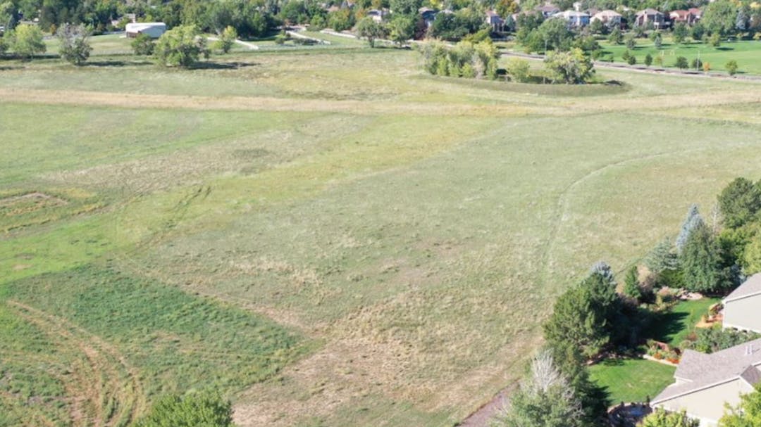
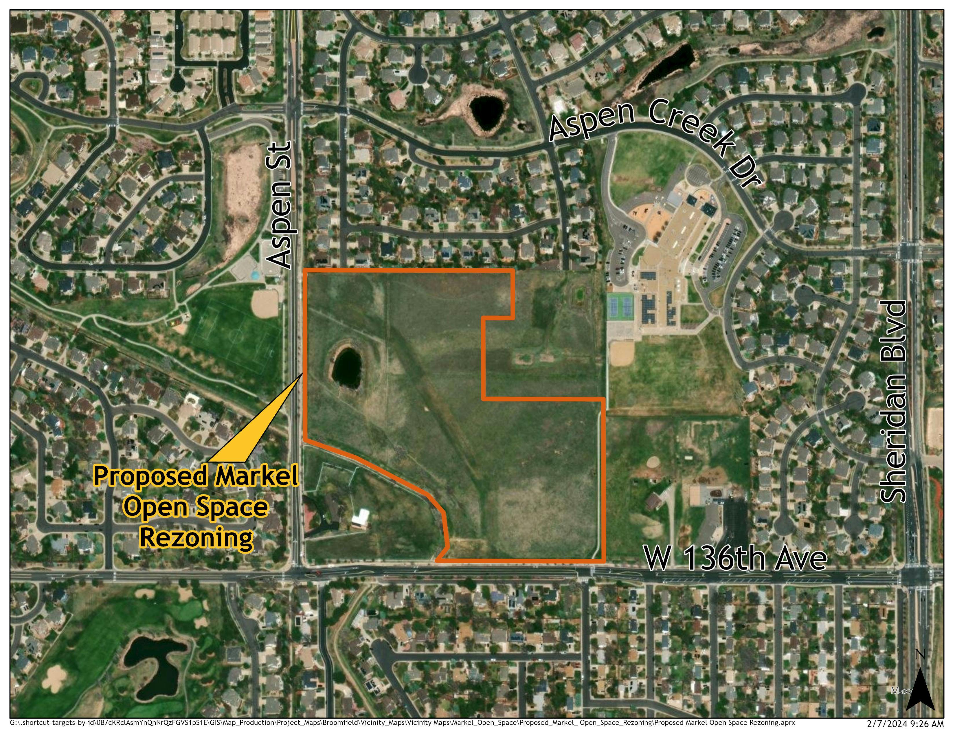
The land use application pertains to an approximately 26-acre parcel owned by the City and County of Broomfield as depicted in the aerial photograph on this page. A future land use application is anticipated to propose the same rezoning and map amendment on an approximately 6-acre, adjacent property currently owned by the Markel Family. Broomfield intends to purchase this property (located to the northeast) and would pursue the land use changes following purchase of the property. The larger, Broomfield-owned property currently contains a small pond area lined with tall cottonwood trees. The smaller, privately-owned property to the northeast contains a plugged and abandoned well head. Both properties are addressed in the Markel Open Space Plan recently completed by the Open Space and Trails Department and Capital Improvements Division which includes trails and seating areas throughout the site for public use. The Broomfield City Council approved this Plan on December 12, 2023. There are no changes proposed to this recently approved Markel Open Space Plan. For more information on this approved plan, please visit the Broomfield Voice project page.

Aerial Map showing property boundary for the application.
Background on the Open Space District
City Council approved the new Open Space zone district on December 5, 2023. The Open Space and Trails Advisory Committee also vetted the details of the Open Space Zone District. The rezoning of this property will help with transparency in zoning for current and future residents. By rezoning the property to the OS district the public will more easily be able to find the allowable uses on these city-owned properties and understand the development requirements such as allowed building height and setbacks. This rezoning to OS will also help to clarify the development process for city-owned property.

Map of the Markel Open Space Plan
Project Details
Applicant: City and County of Broomfield
Location: 5765 W 136th Ave - Northeast of the intersection of W 136th and Aspen St
Project Type: Rezoning and Comprehensive Plan Land Use Map Amendment
City and County Staff Analysis
Zoning, Surrounding Uses and Comprehensive Plan: The purpose of this rezoning and map amendment is to align the parcel’s zoning and use with the approved use of the site. The current zoning permits a range of uses that are not consistent with an open space property such as single-family residences and limited commercial uses such as nurseries and veterinary clinics. Rezoning the parcel to the OS district will limit the permitted uses at the site to those outlined in section 17-07.1 of the Broomfield Municipal Code including native natural areas, passive trails, viewing wildlife areas, benches, shade structures, and other similar uses. The approved Markel Open Space Plan will continue to define the specific uses that are allowed on this site.
Landscaping, Open Lands, Parks and Trail Amenities: The Markel Open Space was purchased with Open Space funding from the Open Space and Parks Sales and Use Tax, which also ensures that the land will remain as open space. The Open Space protection provisions of the Broomfield Charter Section 18.3 will also continue to be applicable. The proposed rezoning to open space is consistent with the Open Space, Parks, Recreation, and Trails Plan (2024) vision for the property as protected for open space purposes.
Possible Key Issues: Currently, there are no key issues identified.
Public Engagement Summary
Six comments and one question were received in the public comment forum for this proposal.
ARCHIVED
City Council approved the rezoning of a portion of the Markel Open Space from the legacy Boulder County Agricultural A(B) district to the Broomfield Open Space OS district on July 30, 2024. A Comprehensive Plan land use map amendment to change the property land use designation from residential to open lands was also approved as part of this application.
Submit your questions about the application below. City and County of Broomfield staff will respond to your question within 2-3 business days.
City and County of Broomfield staff are required to be neutral parties in the development application process and can only restate what information the developer has shared in their application. If you would like to share your feedback with City Council please use the “Comments” tab.
Location

Who's Listening
-
Planning Manager

Email Planning@Broomfield.Org