

Rally Park
ARCHIVED
This project was recommended for approval by the Land Use Review Commission (LURC) during a public hearing on Monday, January 26th, 2026, and received final approval from City Council on Tuesday, February 24th, 2026.
Project Summary
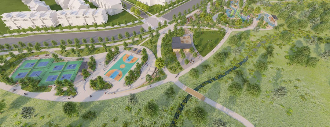
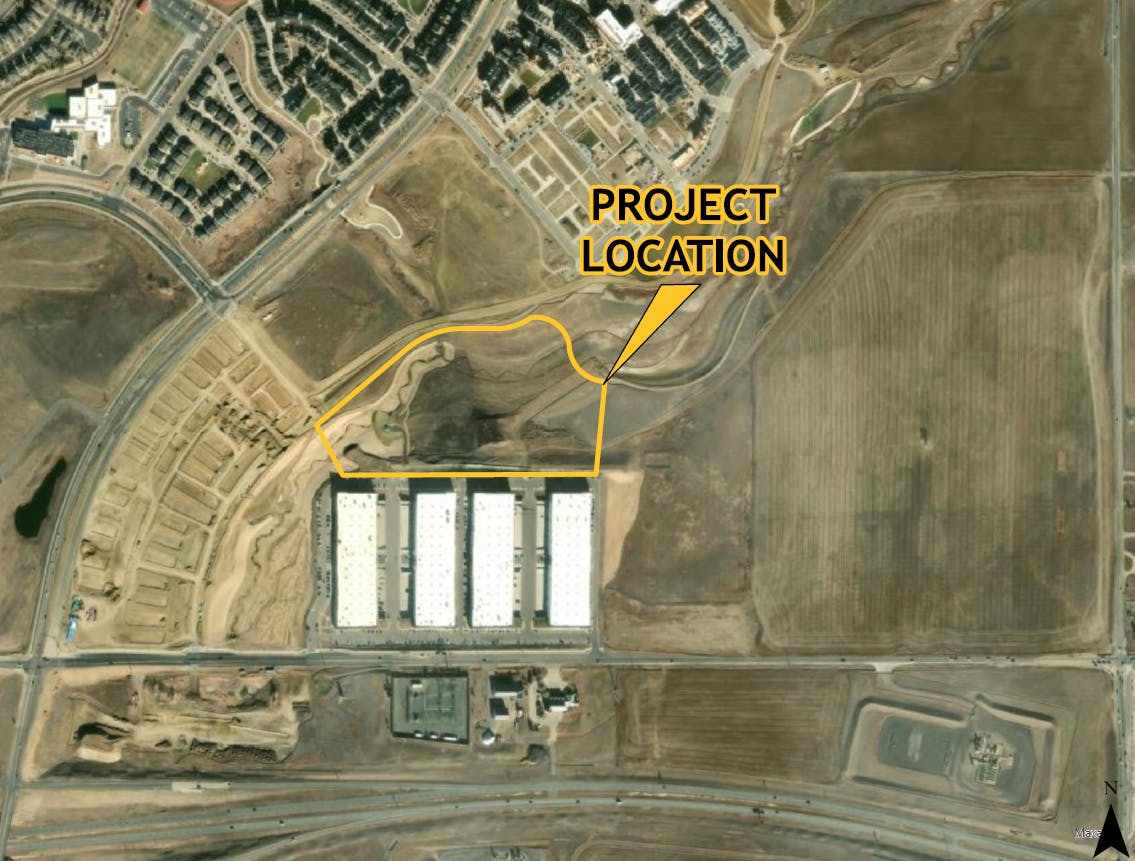
This is a development review application for a proposal to construct a new public park. The subject site is currently undeveloped, and is located north of W 160th Ave and just east of Sheridan Pkwy. Per the submitted application, the new park, Rally Park, is planned as a regional-scale and cultural destination for both Baseline residents and the greater Broomfield community. The Site Development Plan establishes several key features including a signature playground, a restroom pavilion, pickleball courts, a game and sport zone, passive picnic and nature area, and regional trail connections.
The project description provided by the developer, McWhinney, indicates that this project for the approximately 10.75 acre site would be completed in a single phase. Furthermore, the project will continue the progression of Parklands improvements, such as Parklands South and The Big Green.
The Final Plat and Site Development Plan for Rally Park was reviewed by all applicable referral agencies. Final Plat and Site Development Plan were reviewed by the Land Use Review Commission at a public hearing, where the Commission voted to recommend approval. The Final Plat and Site Development Plan were also reviewed by the Broomfield Council with a condition that the developer provide off-street ADA parking to serve the parklands.
Project Details
Applicant: McWhinney
Location: North Park Filing No 2 Replat D & F
Project Type: Development Review for Park
City and County Staff Analysis
Zoning, Surrounding Uses and Comprehensive Plan: The subject parcel is zoned Planned Unit Development (PUD), and is subject to the North Park PUD Plan land use regulations. The proposed park use is consistent with applicable PUD and the existing development pattern in the area, as this will be an extension of the existing park lands to the northeast.
The Broomfield Comprehensive Plan land use designation for the subject property is “Mixed-Use Commercial” and "Open Lands". The open land and park proposal is consistent with the Comprehensive Plan designation for the property.
Parking, Trail Connections, and Park Amenities: Under this proposal, all parking will be accommodated via parallel, on-street, parking on both sides of Promenade Street. The trails that are proposed as part of the Rally Park development will connect to the existing, and future, trails that serve the surrounding area. Park amenities include pickleball courts, a basketball court, picnic areas and shelter, and a large featured playground.

Key Issues
No key issues have been identified at this time. Should any key issues be raised during the review of the project, this section of the page will be updated to reflect such. Those key issues will be shared with City Council as part of the development review staff memorandum.
Public Engagement Summary
Following the review of the formal application, public hearings were scheduled in accordance with the application review process timeline. Public notices were be sent to property owners within 1,000 feet of this project, sign(s) were posted on the property and a notice was published in the Broomfield Enterprise newspaper.


-
Senior Planner

Phone (303)464-5668 Email abradshaw@broomfield.org