
Broomfield Heights Stormwater and Pedestrian Improvements
This Broomfield Voice page will no longer be updated, though project background information will continue to be hosted here. For a project summary and general project information please visit the project's new webpage.
Please visit the American West Construction project page for construction information and updates. This website is the best source for up-to-date construction status information. Construction started in February 2025.
Community Engagement Summary
The City and County of Broomfield collaborated with ICON Engineering and their sub-consultant, NHN Consulting on a Public Engagement Plan as one of the first tasks of Phase 1 in January 2023. Three in-person public meetings were held Phase 1, in addition to other input opportunities such as online surveys, small group meetings, etc. Community input along with floodplain and stormwater data, current regulations, and best engineering practices helped identify and influence alternatives for W 3rd Avenue that address stormwater and pedestrian deficiencies.
A fourth public meeting was held during Phase 2 to share updates on the design progress. And, a fifth public meeting was held at the end of January 2025 to share information about upcoming construction activities.
Project Scope
This project seeks to reduce flood risk to existing properties in Broomfield Heights while improving the pedestrian environment within the project area, and establishing safer walking and biking connections to Emerald Elementary School.
City and County of Broomfield online floodplain map:

Phase 1 - Alternatives Analysis
The City and County of Broomfield hired ICON Engineering to complete an Alternatives Analysis to identify recommended options for stormwater, floodplain, and multimodal improvements. This phase of the project kicked off in January 2023.
Phase 2 - Design and Engineering
Once preferred alternatives are identified as part of Phase 1, the project team will proceed with design and engineering, securing required permits and producing construction documents. Phase 2 was completed from approximately July 2023 thru July 2024.
Phase 3 - Construction
Following design, the City and County of Broomfield conducted a competitive procurement process in the Fall of 2024 to select American West Construction as the contractor for the project. A construction contract was executed in December 2024. Construction began in February 2025. Please visit the American West Construction project page for construction information and updates.
Project Background
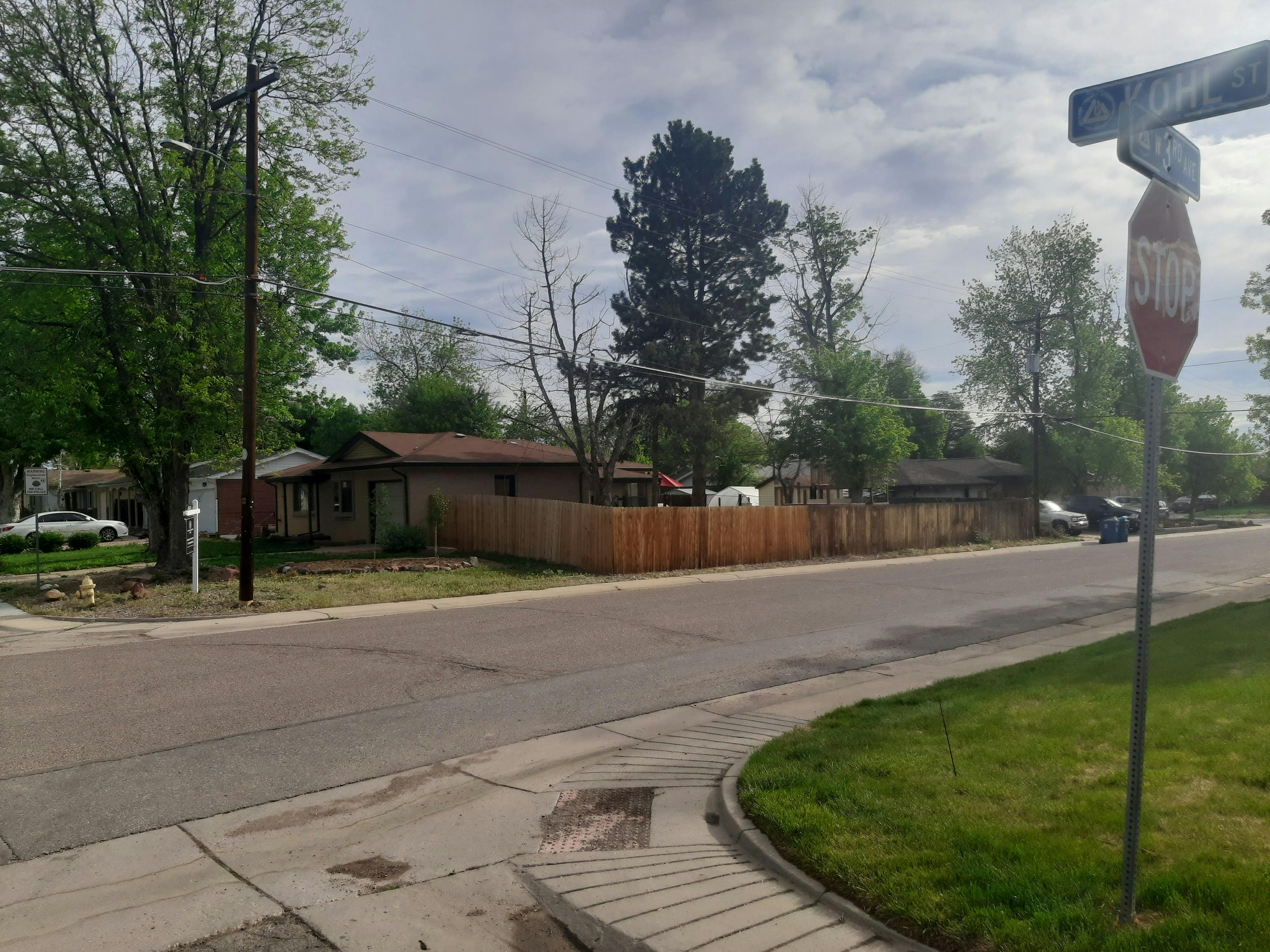
Broomfield Heights Filing 1, south of Midway Boulevard, is a historic neighborhood that was constructed in 1956 and 1957 before Broomfield was incorporated in 1961. Currently, this neighborhood has the highest concentrations of residential properties in the floodplain in Broomfield. This project seeks to contain and convey floodwaters from the start of the effective regulatory floodplain at Nickel St. and W. 120th St Ave./Hwy 287 to where they join the City Park Channel between W. Midway Blvd and Emerald St., reducing flood risk for existing properties.
The 2019 Broomfield Bicycle and Pedestrian Assessment identified the 3rd Avenue sidewalk, which is only 2.5 feet wide in this area, as a priority for further evaluation, and several of its minor cross streets as needing intersection crossing improvements- namely non-compliant ADA ramps and lack of crosswalks. In addition to addressing floodplain/ stormwater issues, this project will improve the pedestrian environment in this area, establishing a safer walking and biking connection to Emerald Elementary School. Specifically, the project will explore options for pedestrian improvements along 3rd Avenue from approximately Nickel Street near the Flatirons Park Apartments to Garnet Street, near Emerald Elementary School.
This project is funded by Coronavirus State and Local Fiscal Recovery Funds (SLFRF) created by the American Rescue Plan Act of 2021 (ARPA). The City and County of Broomfield allocated approximately $9M of its SLFRF funds in total for both the stormwater and pedestrian improvement portions of the project, inclusive of both professional services and construction.
-
Community Open House #4
Share Community Open House #4 on Facebook Share Community Open House #4 on Twitter Share Community Open House #4 on Linkedin Email Community Open House #4 linkOn May 1, 2024 a fourth Community Open House was hosted at Emerald Elementary School to share a design update. Please see the "Project Documents" section to the right for information that was presented that evening, including a copy of the presentation.

 Image Caption
 -
Conditional Letter of Map Revision
Share Conditional Letter of Map Revision on Facebook Share Conditional Letter of Map Revision on Twitter Share Conditional Letter of Map Revision on Linkedin Email Conditional Letter of Map Revision linkA Conditional Letter of Map Revision Report was submitted to FEMA for review in January 2024. A Conditional Letter of Map Revision (CLOMR), is FEMA’s comment on a proposed project that would affect the hydrologic or hydraulic characteristics of a flooding source. This project does not create a rise in water surface elevation on the City Park Channel- South Tributary with the proposed project modeling. No insurable structures will be negatively impacted as a result of the project, in fact, a significant number of structures (buildings) will be positively impacted.
The project design is still in its early stages, but as a result of the project's proposed stormwater improvements as many as 89 apartment units, 9 single-family houses and 1 commercial building would no longer be within the effective floodplain!

Note this image has a typo. It was prepared in January 2024, not 2004.
-
W 3rd Avenue Preferred Alternative
Share W 3rd Avenue Preferred Alternative on Facebook Share W 3rd Avenue Preferred Alternative on Twitter Share W 3rd Avenue Preferred Alternative on Linkedin Email W 3rd Avenue Preferred Alternative linkBased on community input gathered throughout the Phase 1: Alternative Analysis phase, a Preferred Alternative for improvements within the project area has been identified. The proposed improvements include:
- 8-ft multi-use path on the south side of 3rd Avenue
- 5-ft sidewalk on the north side of 3rd Avenue, closing the gap near Marble Street
- Parking on the north side of 3rd Avenue east of Laurel St and on the south side west of Marble St
- Striped crosswalks throughout the corridor and traffic-calming bump-outs at key intersections
- New storm inlets and underground storm drain throughout the corridor
- Reduced size of the 100-year floodplain and severity of nuisance flooding
***All proposed improvements are conceptual at this time and subject to engineering and funding constraints. Proposed improvements may vary during Phase 2: Design and Engineering.***

-
W 3rd Avenue Alternatives
Share W 3rd Avenue Alternatives on Facebook Share W 3rd Avenue Alternatives on Twitter Share W 3rd Avenue Alternatives on Linkedin Email W 3rd Avenue Alternatives link
The Project Documents and Project Videos sections have information presented at Community Open House #2 on May 2, 2023. The Presentation Video (6 minutes) is a great place to start. The Presentation Boards and Board Summary provide more detail on the information presented with larger versions of the alternatives.

Project Documents
-
 Community Open House #4
-
Phase 1: Alternative Analysis
-
W. 3rd Ave Traffic Data
-
Community Open House #3
-
 Open House #3 Roadway Roll Plot (4.68 MB) (pdf)
-
Open House #3 Stormwater Roll Plot (4.83 MB) (pdf)
-
Open House #3 Presentation Boards (English y Español) (10.8 MB) (pdf)
-
Open House #3 Preferred Alternative (3.6 MB) (pdf)
-
Open House #3 Flyer (English y Español) (213 KB) (pdf)
-
Open House #3 Postcard (1.16 MB) (pdf)
-
-
Community Open House #2
-
Community Open House #1


Project Videos


Who's Listening
-
Phone (720) 248-7067 Email info@bfheights.com